


Land trusts protect more than 9 million acres in America. These organizations, state-run, and otherwise, have the challenging responsibility of maintaining facilities, nurturing biodiversity, and restoring habitats.
These organizations also organize events which help promote their work and generate funds. Trusts are always striving to steward what has been granted to them while also adopting new spaces as often as possible.
9 million acres.
How do you manage 9 million acres?
No matter the size of the teams, it is nearly impossible for any group to manage millions of acres, holistically and in real-time. Impossible, at least, before the integration of Geographic Information Systems (GIS), high-resolution aerial imaging, and laser mapping. With these innovative survey technologies and the data analysis software that goes with it, trusts are able to use geospatial mapping revolutionize their conservation and restoration efforts. Suddenly, everything can be seen -- in context!
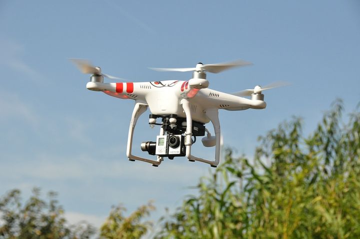
The complex coordination of map layers enables conservationists to see a million points of data in a comprehensible image. Flora, fauna, water levels, slopes, trails, nutrient concentration -- all of these data points can be collected in a season with a team of drones, where, previously, human surveyors were lucky if they could get 1/10th of that data in a year.
Real data is now phasing out projections and extrapolations derived from sample data.
These images allow the professional rangers and stewards to demonstrate need and improvements in a way which donors can appreciate, even if they are not botanists or ecologists.
This is great news. Now, people can better appreciate the conditions of our natural spaces no longer limited by what a person can see on the ground, or what a bird can see from above, but instead a thorough rendering of visual information paired with more nuanced data conservationists can share their progress with donors and visitors alike.
Geospatial mapping does not only help trusts operate with more timely and visual data, these developments are resulting in significant savings. The delegation of data collection to drones and other systems allows surveyors to spend their time making changes instead of wandering around.
Ultimately, the adaptation of technological methods in land management will enable trusts and conservation efforts to redirect their savings into the acquisition of more land making a more abundant, accessible, and healthy ecosystem which we can all enjoy, whether we have 2 legs, 4 legs, or no legs at all!