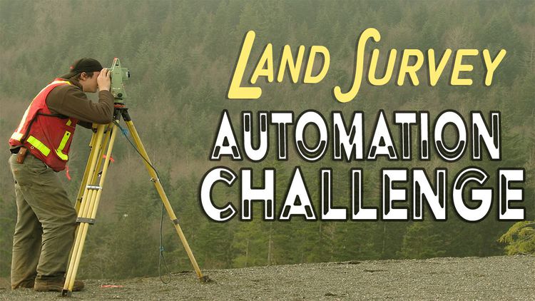
The Problem
Can you disrupt an industry stuck in the stone age? Tech is sweeping across every single industry, turning traditional business models on their respective heads.
Next up? Land Surveys.
Can you bring drones, satellites, software engineering, or even harness pre-existing data to significantly expedite commercial real estate transactions?
Commercial real estate isn’t a “big” industry -- it’s massive. In fact, go ahead and take a guess.
Nope.
Try again.
Bigger.
How about $15 trillion per year?
We’re talking global-economy-scale relevance, here.
Unfortunately, the process for completing these transactions is frustratingly antiquated. As a result, the wealth of time, money, and expertise needed is unthinkable.
A notorious component of successful transaction is the boundary survey. Not only can these surveys take more than a month to complete, but they’re incredibly expensive (some can cost more than $5,000) and need to be conducted on-site.
..by a human.
But what if there was a better way to conduct a successful survey?
What if commercial real estate developers could conduct not just any survey, but an ALTA certified survey remotely, and at a fraction of the current market cost?
By channeling the power of tech, we want to make boundary surveys more accurate, less expensive, and capable of accelerating the process for real estate and real estate financing transactions.
TL;DR: we want a way to automate a full-blown ALTA survey.
Why does this problem exist?
Simply put: no survey, no title insurance. No title insurance, no real estate transaction.
In a world where almost everything else has been optimized, why hasn’t the boundary surveying process been automated?
Boundary surveys are generally complex, with the ALTA type being particularly intricate. A surveyor has to actually travel to and explore the site, before reviewing title and actually plotting the survey (a process that can easily take more than a month) with title review alone taking 2 to 3 weeks.
Creating a solution capable of doing all this—of highlighting improvements, easements, encroachments, rights-of-way, and the various other elements of land ownership—isn’t for the faint of heart.
ALTA is also a trade association, offering title insurance and providing licensing rights to surveyors who want to be certified to conduct an ALTA survey. As you might imagine, they’re invested in maintaining the status quo. This can equal pretty serious resistance to new technology perceived as a threat.
These two roadblocks are adding an entire month (at the very least!) to each and every commercial real estate transaction in the United States.
The Challenge Breakthrough
Through the limitless power of tech, our mission is to help commercial real estate modernize as so many other industries have already. We want to bring property development and investment into the 21st century by streamlining one of the most bloated components of any transaction.
What You Can Do To Cause A Breakthrough
- Click ACCEPT CHALLENGE above to sign up for the challenge
- Read the Challenge Guidelines to learn about the requirements and rules
- Share this challenge on social media using the icons above. Show your friends, your family, or anyone you know who has a passion for discovery.
- Start a conversation in our Forum to join the conversation, ask questions or connect with other innovators.
Challenge Breakthrough
Design and produce a method to automate the ALTA land survey to significantly reduce the time and expense required to complete it.
Overview
The Land Survey Automation Challenge aims to significantly expedite real estate and financing transactions, by drastically lowering the cost and time burden of the land boundary survey. The Challenge seeks a technology that efficiently and remotely automates the land boundary survey process. We welcome entrepreneurs, researchers, scientists, students, and anyone eager to contribute, to jump into this challenge and to find a solution. To register for the challenge, click the “ACCEPT CHALLENGE” button above.
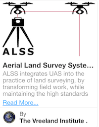
What is an ALTA Land Survey?
The American Land Title Association requires a survey of land for the issuance of a title or mortgage insurance policy. The survey ensures that everything about the land is known, to ultimately avoid expensive legal challenges down the road. These survey standards are set by ALTA and the National Society of Professional Surveyors. According to the current standards, an ALTA survey must consist of:
- on-site fieldwork
- a map with details on how it relates to property documentation
- any relevant information about the property, as requested from the client in Table A
- certification of the survey
While these surveys are industry standards, some states and countries can set their own standards for land title surveys.
**For the purpose of this Challenge, all competitors will need to follow the US guidelines set forth by ALTA for survey precision standards. All other current ALTA standards that may be replaced by technology (i.e.: on-site surveyor) are not required for eligibility.
ALTA surveys loosely consist of two portions: the on-site field survey of the property and the discovery of all legal documents pertaining to the property (learn more about the title search). This fieldwork survey locates not only the boundaries of a property as specified in the land title, but also any improvements, monuments, utilities, and anything else that is physically located on the property pertaining to the title. This information is notated on a map of the property with notation explaining the maps' relation to any pertinent legal documentation. This map must show any monuments, boundary descriptions and dimensions, rights of way, easements, buildings, lines of possession and improvements along the borders, as well as utilities.
We recognize the significant burden of discovering all legal documents pertaining to the property, as well as the importance of related documents to conduct a land survey. We are focusing all efforts of this prize on the technological progress and innovation specifically as it pertains to the land surveying component. As such, any leg work required for teams to acquire historical documents in order to perform a survey does not need to be calculated in the overall time or human intervention factors of this challenge.
For additional information regarding ALTA Surveys, please visit the Resources added to the Challenge Page or see a comprehensive summary here.
Challenge Structure
There are two phases to this challenge:
- Concept Phase: COMPLETE
- See winners here.
- Prototype Phase: OPEN TO SUBMISSIONS
- Build your solution and be the first to prove eligibility
Anyone is welcome and encouraged to enter the Prototype Phase, whether or not you participated in the Concept Phase.
Prizes
The ALTA Land Survey Automation Challenge will award prizes totaling $102,500 USD.
- Concept Phase: Meet the winners here!
- Prototype Phase: One grand prize of $70,000 and two Finalist prizes of $5,000
Timeline
September 14, 2016, 9:00 am PST Challenge Launch
February 16, 2017, 8:59 pm PST Concept Phase Submission Deadline
April 25, 2017, 9:00 am PST Concept Phase Winners Announced
April 25, 2017, 9:00 am PST Timeline for Prototype Phase Announced
October 12, 2017, 9:00 am PST First submission to meet the requirements will win.
Prototype Phase
The Prototype Phase provides an opportunity to demonstrate how your solution works. Individuals and teams must build a working prototype of their technology, conduct two ALTA land surveys, and complete the Prototype Phase Submission Form detailing their achievement in the fulfilling the challenge criteria.
Upon declaration, The William Warren Group will evaluate the first entry under guidance from relevant experts. Innovators may be required to provide additional information and/or further proof of a working prototype. Once preliminarily verified, the declaring individual or team will be invited to attend a Demo Day event held at The William Warren Group headquarters located in Santa Monica, California. The William Warren Group will host an in-person survey to be conducted at a storage facility in the greater Los Angeles area. If teams are unable to attend the event, they must be able to send all required equipment to The William Warren Group headquarters, complete with a detailed set of instructions for a 3rd party, neutral operator to perform the required survey.
The Grand Prize Winner will receive up to $70,000, and reimbursed with up to $5,000 to help cover the costs of travel and accommodations.
Prototype Phase Judging Criteria
Challenge Goal: The winning team must prove automation of ALTA land surveys by conducting, from start to finish, two land surveys in less than 15 hours per survey (excluding the time required to collect historic land title information).
|
Minimum Requirement
|
Description
|
|
Survey Execution
|
Two ALTA reports conducted using the solution and submitted via HeroX.com to William Warren Group
|
|
Property Type
|
ALTA surveys conducted for two commercial self-storage facilities that are each on at least two acres of land and contain at least 750 storage units.
|
|
Data Collection: Remoteness
|
Able to collect survey data from a range of at least 5 kilometers from the operator (if there is an operator).
|
|
Report Generation: Autonomy
|
Less than 10% of the time it takes to generate the report (from the completion of the survey data collection to the production of the final deliverable) requires human activity.
|
|
Compliance
|
Final report is conducted according to the “Minimum Standard Detail Requirements for ALTA/ACSM Land Title Surveys” as adopted by ALTA, ACSM and NSPS in 2016. (see document in Resources Provided)
|
|
Deliverable
|
Final Deliverable is made available by automating an exported report in a presentation quality standard that is acceptable to the ALTA Standards. (see Resources Provided)
|
|
Time
|
All required land data can be collected and the report can be generated within the minimum time threshold of 15 working hours per survey.
|
|
Data Management
|
Solution is able to securely store and manage all required amounts of spatial information on the cloud, accessible in real-time.
|
Note: We recognize the significant burden of collecting historic land title information, as well as the importance of related documents to conduct a land survey. We are focusing all efforts of this prize on the technological progress and innovation specifically as it pertains to the land surveying component. As such, any leg work required for teams to acquire historical documents in order to perform a survey and generate a report does not need to be calculated in the overall time or human intervention factors of this challenge.
In the event of a close call, judges will ultimately rank leading submissions on the level of Complexity: Competitor selects two commercial self storage facilities that contain a level of complexity, in order to prove competency with higher-level automation. Such complexities can include but are not limited to: property size, Table A criteria fulfillment, previous survey errors, discrepancies between monuments found, abundant vegetation, weather conditions, and rural versus urban setting.
DEMO DAY
Upon declaration, The William Warren Group will evaluate the first entry under guidance from relevant experts. Innovators may be required to provide additional information and/or further proof of a working prototype. Once preliminarily verified, the declaring individual or team will be invited to attend a Demo Day event held at The William Warren Group headquarters located in Santa Monica, California. The William Warren Group will host an in-person survey to be conducted at a storage facility in the greater Los Angeles area. If teams are unable to attend the event, they must be able to send all required equipment to The William Warren Group headquarters, complete with a detailed set of instructions for a 3rd party, neutral operator to perform the required survey.
The Grand Prize Winner will receive up to $70,000, and reimbursed with up to $5,000 to help cover the costs of travel and accommodations.
Additional Rules
Concept Phase
Up to five top scoring teams will be recognized with up to $5000 award each.
Prototype Phase
Upon declaration, The William Warren Group will evaluate the first entry under guidance from relevant experts. Innovators may be required to provide additional information and/or further proof of a working prototype. Once preliminarily verified, the declaring individual or team will be invited to attend a Demo Day event held at The William Warren Group headquarters located in Santa Monica, California. The William Warren Group will host an in-person survey to be conducted at a storage facility in the greater Los Angeles area. If teams are unable to attend the event, they must be able to send all required equipment to The William Warren Group headquarters, complete with a detailed set of instructions for a 3rd party, neutral operator to perform the required survey.
The Grand Prize Winner will receive up to $70,000, and reimbursed with up to $5,000 to help cover the costs of travel and accommodations.
Participation Eligibility
The ALTA Land Survey Automation Challenge is open to all individuals, private teams, public teams, and collegiate teams. Teams may originate from any country. Submissions must be made in English. All challenge-related communication will be in English. For the purpose of this Challenge, all competitors will need to follow the US guidelines set forth by ALTA.
No specific qualification or expertise in the survey field is required. Challenge organizers encourage outside individuals and non-expert teams to compete and propose new solutions. To be eligible to compete, you must comply with all the terms of the challenge as defined in the Challenge-Specific Agreement, which will be made available upon registration.
Registration and Submissions
Submissions must be made online (only), via upload to the HeroX.com website, on or before the stated deadlines. All uploads must be in PDF format. No late submissions will be accepted.
Selection of Winners
Based on the winning criteria, prizes will be awarded per the Judging Criteria section above. In the case of a tie, the winner(s) will be selected based on the highest votes from the Judges.
Judging Panel
The determination of the winners will be made by a group of people including experts in ALTA surveys, machine learning, aerial data collection, data management, general technology experts and more.
Intellectual Property
All intellectual property rights will remain with the innovator. If the innovator is eligible for a Prize, they must agree to grant to the the Challenge Sponsor, William Warren Group (WWG) a royalty free, non-exclusive license in respect of all such intellectual property rights. Please see the Challenge-Specific Agreement for full details
Post-prize activities may include efforts to commercialize the winning solution developed in the competition. The winning team has an opportunity for additional collaboration with William Warren Group, via a partnership to commercialize the winning technology. Exact terms will be mutually negotiated.
The Challenge Sponsor, William Warren Group (WWG), is a privately held, entrepreneurial real estate company that focuses on the development, acquisition and management of self storage properties across the nation. Since its founding in 1994, WWG has established an industry wide reputation for building first class projects and operating its stores with integrity, professionalism and originality. More information on WWG can be found at www.williamwarren.com or www.storquest.com
Additional Information
- By participating in the challenge, each competitor agrees to submit only their original idea. Any indication of "copying" amongst competitors is grounds for disqualification.
- All applications will go through a process of due diligence; any application found to be misrepresentative, plagiarized, or sharing an idea that is not their own will be automatically disqualified.
- All ineligible applicants will be automatically removed from the competition with no recourse or reimbursement.
- No purchase or payment of any kind is necessary to enter or win the competition.
- Void wherever restricted or prohibited by law.